Nha Trang weather forecast for today and the next 14 days
Use the hourly forecast to pick the right part of the day and the two-week outlook to pick your week. Before swimming or taking an island trip, check gusts, waves and any active warnings as well.
Written by Tụi mình mê biểnUpdated

Photo: bvi4092
Start with the hourly forecast for Nha Trang weather today, then check wind, waves and any active warnings. A rainy daily icon does not mean rain every hour. For an island tour, the condition of the sea and the operator's latest instructions matter as much as the forecast for the town.
Nha Trang weather today and the next 14 days
Automatic forecast for central Nha Trang, refreshed each time you open the page
Loading forecast...
This is an automatic forecast. Official weather warnings, no-swimming flags, lifeguard instructions and boat suspensions always come before the numbers on screen.
Nha Trang weather now: the first 3 things to check
Look at rain timing, wind gusts and weather warnings before anything else. Air temperature helps you dress for the day. The other three pieces of information are more likely to affect swimming, boat departures and outdoor travel.
“Nha Trang weather now” refers to conditions close to the latest observation or model update. “Today” can cover the whole day or the hours still ahead, depending on how the forecast service presents its data. These are not interchangeable. The hour-by-hour table for today in the tool starts from the hour you open the page: open it in the afternoon and you see only the hours still ahead.
Travelers planning from abroad can use the current outlook to understand the likely conditions on arrival. Once you are in Nha Trang, check again before each trip. Use Vietnam local time, UTC+7, when comparing your itinerary with forecast hours. This avoids reading a rain window in the time zone of your home country.
No single forecast number gives permission to swim or sail. A warm day may have difficult seas. A low rain probability is not a safety statement. Official warnings, local beach restrictions and the boat operator's instructions take priority over an automated weather symbol.
Nha Trang weather today: choose the right part of the day
A daily forecast is useful for seeing the expected high, low and general conditions. It is less useful for choosing an exact departure time. Open the hourly view to see whether showers are expected in the morning, afternoon or evening.
Suppose the forecast shows a wet spell at 5-7 pm. A walk along Tran Phu beach at 8 am can still go ahead. Equally, a sun icon for the day does not exclude a thunderstorm later. Look at the hours that overlap your actual activity.
An easy day on land lets you move a beach walk to a drier part of the day. Leave a museum, a long lunch or another flexible stop for a wetter period. The order of your activities matters more than following an itinerary written weeks earlier.
A boat excursion needs a separate check. Find out when you must arrive at the pier, when the boat is expected to depart and when the operator confirms whether the trip will run. The town forecast cannot describe every stretch of water on an island route. It should never replace a marine forecast or operational information.
Residents can apply the same principle to commuting. The daily icon may be of limited use when the real question is whether rain will affect a school run or the journey home. The next one to six hours tell you more than the daily summary.
Nha Trang weather tomorrow: what to decide the night before
Use tomorrow's forecast to organize the activities you have already booked. Read the high and low temperatures first, then focus on rainfall during the hours you will be outside. A morning island tour should be checked against the morning and early-afternoon outlook. Dinner outdoors needs an evening forecast instead.
An evening forecast may give a relatively clear view of the following morning. It still needs checking again when you wake up. Weather models incorporate new observations and may shift the expected timing of a shower.
Keep plans flexible when showers are expected at a particular time. You might visit Po Nagar Cham Towers during a drier period and leave the Oceanographic Institute for later. The towers are partly outdoors, though, and will not keep you fully dry. A venue's current opening hours should be checked separately from the weather.
Message the island tour operator the day before. Ask for the meeting point, the pier name, the latest departure status and the policy if weather interrupts the trip. Different tours have different refund and rescheduling terms. Ask whether rain alone qualifies for a refund.
If the next morning includes an official weather warning, follow that information instead of relying on yesterday's confirmation. The operator may need to change a route or cancel a departure even when it is not raining in front of your hotel.
How much can you trust a 10-day or 14-day forecast?
Treat the 14-day view of Nha Trang weather as a planning horizon. A 10-day outlook covers the nearer part of your holiday. The extra days make it easier to choose travel dates, pack sensible clothing and reserve a spare day for the sea.
For days 1-3, hourly details can help you arrange the order of activities. For days 4-7, pay more attention to sequences of wet days, wind trends and changes in temperature. For days 8-14, use the forecast as an indication of the broader pattern. The precise hour of rain on day 12 is far more uncertain than the next few hours.
A forecast for the second week may move from rain to cloud and back again after a model update. That is normal. Weather models start with observations of a constantly changing atmosphere. Small differences become more influential the further ahead the calculation runs.
Do not cancel a non-refundable booking just because a distant day carries a rain icon. Look at the confidence of that forecast, how the surrounding days compare and whether you have other workable dates. The purpose of the extended outlook is to help manage uncertainty.
The 14-day strip in the tool covers every day of a two-week holiday, and you can tap any day to open its hour-by-hour table. The later days still carry less forecast detail than the first few. Near-term hourly information and later daily guidance serve different purposes.
Temperature, humidity and the feels-like reading
Daily high and low temperatures describe the expected range across the day. They do not tell you when a shower will happen. They also do not fully describe how comfortable the air will feel while walking along the coast or waiting at a pier.
Humid air can make warm conditions feel hotter, particularly when the breeze is weak. That is why a temperature of around 30°C may feel uncomfortable during a long walk at midday. Carry water, find shade and place longer walks earlier in the morning or later in the afternoon.
The feels-like value is an estimate of how conditions affect the body. It is not the same as the temperature recorded by a thermometer. Read it alongside humidity and wind.
Check the UV index on bright days. Thin cloud is not complete protection from ultraviolet radiation. Sunscreen, a hat and clothing that provides shade are still useful when you expect to spend several hours on a beach or open boat deck.
Traveling with young children or older relatives calls for a slower pace. Plan a proper rest period if the day includes multiple outdoor stops. A comfortable temperature at breakfast does not guarantee that the same walk will feel easy at lunchtime.
What does a 30%, 60% or 90% chance of rain mean?
Rain probability is the chance that a measurable amount of precipitation will occur at a forecast location during a specified period. A 60% chance of rain does not mean that it will rain for 60% of the day. Nor does it mean that rain will fall on 60% of Nha Trang.
Always check the time interval. One service may show a probability for an entire day; another may show a value for each hour. Those figures are not directly comparable without knowing what period they cover. A 60% daily probability and a 20% hourly probability may describe similar conditions.
Probability is not intensity. A relatively high chance might refer to a brief light shower. A lower chance can still involve a heavy shower if rain develops. You need rainfall amounts, weather descriptions and thunderstorm information to understand the likely impact on your plans.
For a short walk near your accommodation, a light jacket or compact umbrella may be enough to keep the schedule flexible. A full day at sea needs more than rain probability. Look at wind gusts, wave forecasts and thunderstorm warnings as well.
Nha Trang can have showers that pass quickly. An icon showing rain for a particular day does not prove that every outdoor activity will be lost. Conversely, a mostly sunny outlook should not encourage you to ignore an active lightning or marine warning.
Rainfall in millimeters: intensity matters as well as totals
Rainfall totals are often shown in millimeters, written as mm. One millimeter of rain is equivalent to one liter of water per square meter of a level surface. It measures the amount of water and says nothing about how long it takes to fall.
Ten millimeters falling within an hour can affect a walk very differently from ten millimeters spread over many hours. A short, heavy shower may interrupt a photo stop, a ride through town or an outdoor meal. Persistent light rain can make shoes, towels and bags difficult to dry.
When comparing two possible beach days, look beyond the daily totals. A dry morning followed by a wet evening may still offer a useful window for a short activity on land. A day with little predicted rainfall can still be unsuitable for watersports when thunderstorms or rough seas are expected.
Rainfall forecasts are estimates. They are not measurements from every street and beach. Local showers can affect northern neighborhoods while the central waterfront remains mostly cloudy. Use the forecast for the actual location you plan to visit when that level of detail is available.
A predicted wet day also does not tell you whether roads will flood. The effects of rain depend on its intensity, duration and local drainage. During heavy rainfall, follow current local advice; a single mm figure cannot tell you that.
Wind speed and gusts: important numbers for the coast
Forecast wind speed describes the more sustained flow of air. Gusts are shorter bursts of stronger wind. Both matter along the coast, but gusts can be especially relevant on a pier, an open boat deck or during a small-craft journey.
Read the unit before comparing forecasts. Kilometers per hour, meters per second and knots represent different scales. Wind direction is the direction the wind comes from. A northeast wind blows from the northeast towards the southwest.
A beach can feel breezy even when the sky is blue and the chance of rain is low. Buildings may shelter the street outside your hotel, while the route across the bay is more exposed. Never treat calm air on a hotel balcony as proof of calm conditions offshore.

Photo: cloud.shepherd (Brian Miner)
There is no universal wind-speed number that tells a visitor whether every island boat can run. Vessel type, route, local sea state and official instructions all matter. Use wind information to ask better questions of the operator, not to issue your own safety clearance.
Look for a change in wind through the day. A tour that starts in relatively mild conditions may face different conditions later in the afternoon. An operator should assess the whole itinerary, return leg included.
Waves and marine weather are not the same as city weather
A city forecast covers rain, clouds, air temperature and wind near land. A marine forecast can also show wave height, wave direction, wave period and conditions over the water. Travelers heading to the islands need both views.
Wave height is commonly reported in meters. Modeled offshore wave height does not give an exact reading for every swimming area or sheltered corner of Nha Trang Bay. Islands, headlands, the sea floor and the direction of incoming waves all influence what happens close to shore.
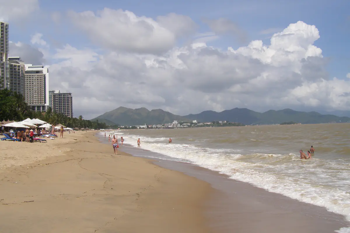
Photo: RG72
Wave period measures the time between successive waves. Two forecasts with similar wave heights may describe a different experience at sea because the period and direction differ. That is one reason not to make a boat decision from wave height alone.
Weather services may combine several marine models and observations. Their forecast locations can be separated by several kilometers from the beach you are visiting. Check the location and timestamp before assuming that a marine number applies to one particular spot.
For swimming, use the beach's flags, designated areas and lifeguard instructions. Boat passengers should rely on the operator's current departure information alongside official marine advisories. A forecast can help you prepare, but it cannot certify an individual beach as safe to enter.
When should you keep, move or cancel an island tour?
A rain icon is not an automatic cancellation notice. You need to distinguish an inconvenient forecast from conditions that stop a service operating safely. The best decision depends on both the weather and the activity you have booked.
Keep the booking when there are no relevant restrictions, the operator confirms departure and the conditions are suitable for the planned route. Cloud cover alone does not make a trip impossible. Sunshine does not guarantee a comfortable sea crossing either.
Ask to reschedule when showers overlap the main activity, gusts or waves are expected to increase, or a neighboring day appears less unsettled. Request the latest operating decision and ask how the provider handles changes, cancellations and refunds. Written confirmation is helpful when several services are included in the ticket.
Many bay and island excursions use Nha Trang Tourist Port at 388 Vo Thi Sau Street, Nam Nha Trang ward, Khanh Hoa province. The port is in the former Vinh Truong area. Not all island attractions use the same departure point, so give your driver the exact pier named on your ticket.

Photo: MIA.vn
A return trip can be affected even when the outward journey starts in good weather. Confirm how the operator communicates a revised return time and whom to contact if your plans change. Families should ask this before boarding, not only after a delay occurs.
Can you swim at Tran Phu beach today?
The long waterfront along Tran Phu Street is convenient for visitors staying in the central Nha Trang area. Unlike an island trip, a beach walk usually does not require a fixed booking. You can change your plans quickly when the hourly forecast shows a passing shower.
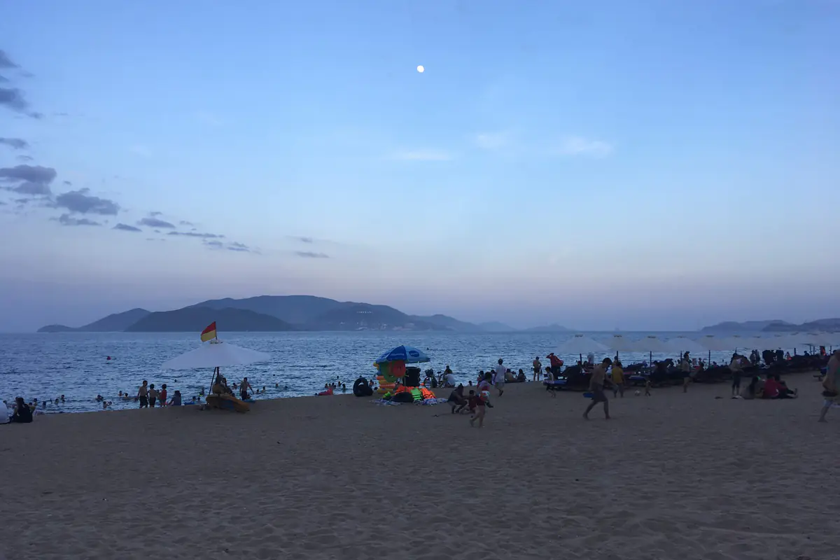
Photo: Christophe95
The best swimming time is not a fixed hour throughout the year. A calm-looking morning can be just as risky as an afternoon. Sea conditions, warnings and the local beach team matter more than an assumed daily routine.
Walking, sitting at a café and swimming have different levels of exposure. A brief shower might be a minor inconvenience for a café visit but a serious reason to leave the water when lightning is present. Choose the activity according to the current conditions.
Keep phones and important documents in a water-resistant pouch if rain is possible. Carry drinking water and sun protection even on cloudy days. Cloud cover is not a reliable measure of how strong the sun will feel later.
Visiting Hon Mun, Hon Tam or Hon Mieu: check the route
An island forecast should not be reduced to the weather at the central beach. The departure port, open-water crossing and destination may have different exposure to wind and waves. A bright photo taken near Tran Phu Street says nothing certain about the sea state between islands.
Snorkeling and diving at Hon Mun have been suspended since June 2022, and anyone hoping to get in the water there should ask exactly which area is open, then about underwater visibility. Recent rain may reduce visibility at some locations. The specialist operator must assess the water conditions for the actual activity. Visitors should not decide independently from a daily rain percentage.

Photo: Vietnamnomad
At Hon Tam or Hon Mieu, ask which parts of the package take place outdoors, where passengers can shelter and what happens if the schedule changes. A day pass with several services can be harder to rearrange than a simple visit on land. Review the ticket terms before paying.
Multi-island tours involve more than one stop and several journeys across water. Conditions can change between those legs. A dry pier says little about conditions at every stop. The same applies to the return crossing later in the day.
Traveling with children requires a little more preparation. Confirm departure and return times, the meeting point and who will provide updates. A spare change of dry clothes and a water-resistant bag can be more useful than trying to carry every item you might need.
Nha Trang's rainy season and the months to watch
The Nha Trang area generally has a wetter season from September to December. October and November are significant rainy months in the broader Khanh Hoa climate pattern. These are historical seasonal tendencies; any particular date can still turn out wet or dry.
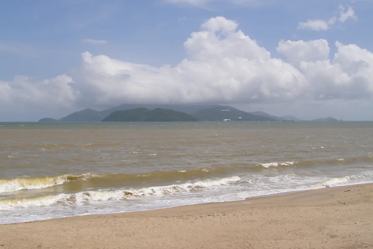
Photo: RG72
During the wetter months, pay closer attention to hourly rain forecasts, official heavy-rain warnings and marine conditions. A sequence of wet days can affect road travel as well as excursions at sea. Visitors on a two- or three-day holiday have less room to move activities than someone staying for a full week.
The drier part of the year often gives more opportunities for beach activities. It does not eliminate isolated showers or windy sea conditions. A trip in March still needs a forecast check, even outside the main wet season.
Rainfall in central Vietnam can be influenced by monsoon conditions, tropical disturbances and other weather systems. A month with a reputation for good weather can still include a difficult period. Use the historical season to plan generally and the current forecast to decide what to do next.
Visitors arriving in November should avoid treating rain symbols as a verdict on the entire holiday. Look for the dry hours within each day, check the sea state and keep activities with flexible timings available. This gives you a practical plan without pretending that the weather will be predictable weeks ahead.
Storms, heavy rain and official warnings
Not every year brings a direct storm impact to Nha Trang. Nevertheless, tropical depressions, storms elsewhere in the region and prolonged rainfall can affect the coast and surrounding roads. The absence of a cyclone directly overhead does not guarantee normal sea conditions.
Read the area and validity period of each warning. A national marine bulletin may refer to a broad stretch of coast that includes Khanh Hoa. Conditions inside a sheltered bay can differ from those offshore, but the official warning still warrants close attention and local confirmation.
Check notices from Vietnam's national meteorological authority, local government and your service provider. When heavy rain is expected, ask your accommodation about access roads and follow any local guidance on flooded routes. Do not attempt to cross flooded roads when the depth or current is unclear.

Photo: Bún bòa
Lightning is a separate concern from ordinary rainfall. Avoid swimming, open-water sports, exposed headlands and seaside structures during thunderstorms. Follow on-site instructions and get to suitable shelter before the rain turns heavy.
Under a storm warning, attractions may close at different times; decide by the affected area and activity. Base those decisions on current official and operator information.
North, south and west Nha Trang after the 2025 administrative changes
Following Vietnam's 2025 administrative reorganization, the Nha Trang urban area includes four wards in Khanh Hoa province: Nha Trang, Bac Nha Trang, Tay Nha Trang and Nam Nha Trang. These are administrative names; the climate is the same across all four.
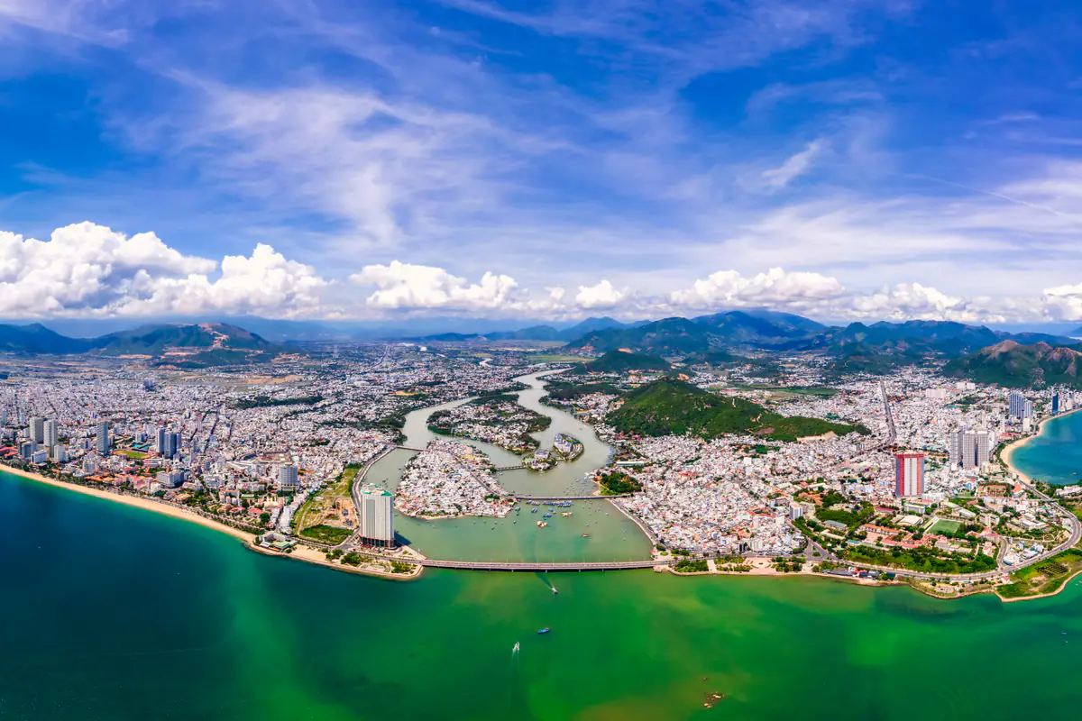
Photo: Hoàng Thạch
Bac Nha Trang (North Nha Trang ward)
Northern coast and neighborhoods further inland
Bac Nha Trang combines the former Vinh Hoa, Vinh Hai, Vinh Phuoc and Vinh Tho wards, together with the former Vinh Luong and Vinh Phuong communes. It covers northern coastal areas and neighborhoods further inland. Search for a forecast close to your exact accommodation or destination if you need local conditions here.
Nam Nha Trang (South Nha Trang ward)
Home to the tourist port in former Vinh Truong
Nam Nha Trang combines the former Phuoc Hai, Phuoc Long and Vinh Truong wards with Vinh Thai and Phuoc Dong communes. The tourist port in the former Vinh Truong area is now in this ward. Boat passengers need to consider both the port location and the weather along their sea route.
Tay Nha Trang (West Nha Trang ward)
Much of it further inland
Tay Nha Trang includes the former Ngoc Hiep and Phuong Sai wards and the former Vinh Ngoc, Vinh Thanh, Vinh Hiep and Vinh Trung communes. Much of the area is further inland than the central waterfront. Local rain can vary between western neighborhoods and the coast during the same afternoon.
Nha Trang ward
Easy to confuse with the wider destination
Nha Trang ward combines the former Van Thanh, Loc Tho, Vinh Nguyen, Tan Tien and Phuoc Hoa wards. This is the name of one current ward, but visitors also use Nha Trang as the name for the wider destination. Do not confuse the two when choosing a forecast location or entering an address.
The wards are close enough to share the same general climate. They do not share identical weather at every hour. A local shower may reach one neighborhood first, while another remains dry. Exposure to sea breezes, hills and nearby waterways can also change how conditions feel.
Someone searching for “North Nha Trang weather” really wants conditions at a real place in the ward. Select a nearby point when possible. A generic Nha Trang prediction is useful for an overview, but it cannot guarantee what is happening outside every building.
Which forecast should local residents use?
Residents of Bac Nha Trang may be interested in rainfall during a commute along the northern coast. People in Tay Nha Trang may need the rain outlook for a journey towards the center. Residents of Nam Nha Trang may be checking conditions around the old Vinh Truong port area. The most relevant forecast depends on the journey, not only the ward name.
For a school run or short commute, the next one to six hours may be more valuable than a 14-day outlook. Check the expected rain during your actual departure and return periods. An outdoor event at the weekend calls for the longer view first and the hourly forecast once the date approaches.
The tool on this page forecasts for one point in central Nha Trang, like any app that offers a single point labeled “Nha Trang.” That point represents one forecast position or model grid cell. It is not a live measurement made simultaneously in all four wards. Local rain can arrive at different times even across a relatively compact area.
Bac Nha Trang is one ward, and the name does not cover every place in northern Khanh Hoa province. Forecasts for Ninh Hoa or Cam Ranh should not be substituted automatically for a place within the four Nha Trang wards. Check the place name and map location before relying on the numbers.
A practical weather plan for 2, 3 or 7 days
Two days and one night: Check your arrival and departure periods first. Put the activity most dependent on sea conditions on the day with the more favorable outlook, subject to the operator's confirmation. Use your remaining time for the waterfront, food and places on land. Ask about rescheduling before paying for an island trip because your spare time is limited.
Three days and two nights: Keep one day flexible for the islands. Leave other days for the central waterfront, Po Nagar Cham Towers, the Oceanographic Institute and local meals. Finalize the order 24-48 hours in advance; a two-week forecast is no fixed schedule.
Five to seven days: Use the 14-day view to identify stretches that look unsettled. A longer stay gives you more options, but it is still sensible to have an alternative island day. Avoid packing every weather-dependent activity into the same morning or afternoon.
On a single-day visit, choose activities that can be shortened or moved easily. A long boat tour has more timing constraints than a walk along Tran Phu Street. Think about how much of the plan you can change when conditions shift.
Do not choose the itinerary entirely from promotional photos of blue skies. Those photos show what a place can look like on a good day. The hourly forecast and operational updates are more useful for that decision.
What to do in Nha Trang when the forecast turns wet
A rainy day does not have to mean staying inside your hotel. Consider activities with substantial indoor areas, restaurants or cafés close to where you are staying. The Oceanographic Institute is one possible option, subject to its current opening hours and the conditions on your route.
Po Nagar Cham Towers is not an entirely indoor attraction. A market can also be inconvenient during intense rain. Choose alternatives by how much shelter they actually offer; not every place in town works in all weather.

Photo: RG72
Families may prefer one backup activity within a short journey of their accommodation. Travelers carrying large bags should think twice before making a long cross-town transfer just to chase a slightly better forecast. A local shower may move by the time they arrive.
If your island tour is canceled, contact the provider about the available refund, credit or date-change process before changing the rest of your plans. Keep written confirmation of any revised arrangements. Weather uncertainty is easier to manage when the booking details are clear.
For a flexible afternoon, eating nearby or waiting for a shower to pass may be perfectly reasonable. Waiting for a brighter sky is not enough when a marine activity is officially restricted. Follow the current operating decision.
Check the forecast at 3 points before your trip
- 7-14 days before
Choose your dates
Use the extended outlook to choose travel dates and pack. Look for possible runs of rainy or windy weather. Keep a backup activity available, but avoid making exact hourly commitments based on the distant part of the forecast.
- 24-48 hours before
Arrange the activity
Open the hourly view for that date. Compare rain timing, gusts, waves and any warnings. Confirm the departure pier, meeting time and rescheduling terms with the tour operator.
- Before you leave
Respond to current conditions
Recheck Nha Trang weather now and the hours immediately ahead. Look at the actual sky and read the latest official and operator notices. A forecast viewed in the morning may have been updated by the afternoon.
These three checks have different jobs. The first helps you choose the dates, the second helps you arrange the activity, and the third helps you respond to current conditions. Re-reading a screenshot from two weeks ago does not accomplish the same thing.
What to pack when rain, sun and wind are all possible
A lightweight rain jacket or small umbrella is useful for passing showers on land. A water-resistant pouch helps protect a phone, passport copy and other important items when you travel by boat. Footwear that dries quickly is often more practical than heavy fabric shoes during a wet spell.
Bring water, a hat and sun protection on bright days. Keep these in your day bag even when the morning starts cloudy. A dry set of clothes is useful after a wet boat ride or an unexpected shower.
If you are prone to seasickness, seek appropriate medical or pharmacy advice before a boat excursion. Wind and wave forecasts can indicate a potentially uncomfortable crossing, but they cannot predict exactly how one person will feel aboard a particular vessel.
Do not overpack simply because several icons in the two-week view show rain. Look at the overall pattern and consider whether you can dry clothes at your accommodation. A small bag for wet items and an extra outfit may be more useful than several pairs of shoes.
Packing does not remove weather restrictions. A good raincoat cannot make an unsafe crossing acceptable. Sunscreen cannot make swimming safe during a thunderstorm. Gear is for comfort and preparation; operational guidance still decides whether you go.
Five common mistakes when reading a Nha Trang forecast
The first mistake is treating a daily rain icon as a prediction of uninterrupted rain. Open the hour-by-hour table and look for actual windows you might use. Many land activities can be shifted without canceling the whole day.
The second mistake is using air temperature as a measure of sea safety. A forecast of 30°C says nothing by itself about local currents, lightning or surf. Follow beach signs and staff instructions regardless of how warm the day feels.
The third mistake is reading city wind but ignoring marine weather. A sheltered street does not describe an exposed boat route. Check gusts, waves and advisories as well as the town forecast.
The fourth mistake is trusting day 14 as much as tomorrow. Extended forecasts are valuable for broad planning but become less certain with lead time. Check again as the date moves into the shorter-range forecast.
The fifth mistake is choosing the wrong location after the ward changes. Nha Trang ward is not identical to the entire Nha Trang destination. Select the nearest available forecast point for Bac Nha Trang, Tay Nha Trang or Nam Nha Trang when local rain matters to your plans.
Final note
Use the 14-day forecast to choose your week and the hourly forecast to choose your morning. Before stepping onto a boat, check the marine warnings and the departure decision, whatever the sunny 30°C icon says.
FAQ
What is the Nha Trang weather forecast for today?
Check the live current conditions and the hourly view for the rest of the day. Pay attention to rain timing, gusts and any warnings. A daily icon is not enough to decide whether to swim or take an island tour.
Will it rain in Nha Trang tomorrow?
Use the next day's hourly forecast to identify likely rain periods and their intensity. A rain symbol does not mean continuous rain. Recheck the forecast the next morning before leaving.
Is a 14-day Nha Trang weather forecast reliable?
It is useful for broad patterns and travel planning. Specific rain timing is less certain during days 8-14. Use nearer-term hourly data and official updates when the activity date approaches.
Does North Nha Trang have different weather from central Nha Trang?
The areas share the same general climate, but local showers and wind exposure may differ at a particular hour. Choose a forecast location close to your accommodation or destination.
Can an island tour run when rain is forecast?
Sometimes it can, but a rain icon alone cannot answer that question. The operator must consider conditions along the route and applicable official restrictions. Confirm directly before traveling to the departure pier.
Related posts

Tools
Can you swim in Nha Trang today? Check the sea conditions
Learn how to check today's Nha Trang sea conditions and decide whether swimming or an island trip is a good idea.

Tools
Which Nha Trang trip fits your budget, 3 days or 4 days?
Calculate your group's Nha Trang travel budget, including return tickets, accommodation, meals, transportation, and activities.

Tools
Nha Trang sunrise time: when to head to the beach in the morning
Check sunrise and sunset times in Nha Trang and plan the best time to visit the beach.